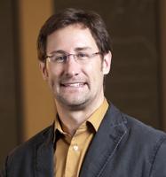
REACCH Connection:
Dr. Gessler leads the Cyberinfrastructure team, ensures secure and long-term data storage with the University of Idaho's Northwest Knowledge Network, and develops research tools scientists can use.
Biography:
Paul Gessler is a professor of remote sensing and geospatial ecology in the Department of Forest, Rangeland, and Fire Sciences at the University of Idaho. He conducted soil-landscape modeling research for seven years at CSIRO Australia and earned his Ph.D. in environmental modeling at the Australian National University in Canberra. He then worked as a visiting researcher at the National Center for Geographic Information and Analysis at UC Santa Barbara before joining the faculty at the University of Idaho in 1997.
As co-director of the Geospatial Laboratory for Environmental Dynamics in the College of Natural Resources, Professor Gessler helps guide geospatial information needs for current Idaho National Science Foundation EPSCoR grants. He is the leader for the NSF EPSCoR cyberinfrastructure (CI) working group and the U.S. Geological Survey-funded IdahoView program. Additionally, he supports the African Predator Conservation Research Organization, a diverse group of researchers, primarily from the fields of veterinary medicine and genetics, whose common goal is to gather knowledge and initiate original research projects examining carnivores in their natural environments.
Professor Gessler will serve a similar role in leading the cyberinfrastructure and data management elements of the new Approaches to Climate Change for Pacific Northwest Agriculture project and also advise a doctoral student in developing web applications for data delivery to researchers and stakeholders. His research specialties include remote sensing and LiDAR analysis for forest ecosystem mapping and monitoring, wildland fire fuels and fire hazard mapping, and soil landscape modeling and mapping.

